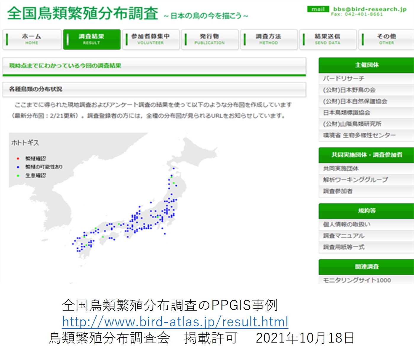
![](https://www.chirisougou.geography-education.jp/wp-content/uploads/2021/11/1235thumbnail.jpg)
1-2-3-5 市民参加型GISとは何ですか。 更新2024年 3月
2024年3月27日1-2-3社会とGIS 2024年新作, Web世界地図, Web地図,3月,world webmap national topographicMap 官製 地形図 2024新教材素材,ラスター地図、topographic-map,各国官製地図,地形図,更新2024年
市民参加,ボランテイアGIS、地図、防災,まちづくり,
2024年3月27日1-2-3社会とGIS 2024年新作, Web世界地図, Web地図,3月,world webmap national topographicMap 官製 地形図 2024新教材素材,ラスター地図、topographic-map,各国官製地図,地形図,更新2024年
関連記事
![Thumbnail of related posts 023](https://i0.wp.com/www.chirisougou.geography-education.jp/wp-content/uploads/2021/12/1112tthumbnail.jpg?resize=150%2C150&quality=89&ssl=1)
1-1-1-2 地理院地図で表示される電子地図の種類と入手法を学ぶ 更新2024年 3月
キーワード 地理院地図 電子国土基本図 基盤地図情報 地理院タイル ズーム ...
![Thumbnail of related posts 010](https://i0.wp.com/www.chirisougou.geography-education.jp/wp-content/uploads/2021/12/thumbnail1115.jpg?resize=150%2C150&quality=89&ssl=1)
1-1-1-5 世界各国の官製Web地図はどこにあるか?-各国のTopographic Mapが見れるサイト 新教材素材 2024年3月
2024年新作, Web世界地図, Web地図, world, webma ...
![Thumbnail of related posts 073](https://i0.wp.com/www.chirisougou.geography-education.jp/wp-content/uploads/2021/11/1114thumbnail.jpg?resize=150%2C150&quality=89&ssl=1)
1-1-1-4 デジタル地図帳を授業にいかすには、どうしたらいいのですか 更新 2024年3月
キーワード 投影するデジタル地図帳 持ち出すデジタル地図帳 ニノマップ Stro ...
![Thumbnail of related posts 058](https://i0.wp.com/www.chirisougou.geography-education.jp/wp-content/uploads/2023/01/12216thumbnail.jpg?resize=150%2C150&quality=89&ssl=1)
1-2-2-16 RESASで地域分析を学びたい 更新2024年 3月
キーワード RESAS, 地域経済分析システム, 自治体間比較, 人口, 産業, ...
![Thumbnail of related posts 001](https://i0.wp.com/www.chirisougou.geography-education.jp/wp-content/uploads/2023/01/1234thumbnail.jpg?resize=150%2C150&quality=89&ssl=1)
1-2-3-4 新型コロナウィルス感染症の流行状況を可視化するGISの有用性 更新2024年 3月
キーワード 疾病地図,流行地図,空間的伝播, 時空間地図, COVID-19, ...
ディスカッション
コメント一覧
まだ、コメントがありません